Grand Teton National Park: Colter Bay Village, Jackson Lake, Jenny Lake, String Lake
We woke up early this morning, packed up our gear, and hit the road for what would be an 8+ hour drive to Grand Teton National Park. The drive from Colorado to Wyoming is not super interesting and is longgg. Be prepared to feel like you’re all alone on the road for several hours. Cue up some good tunes and watch how quickly the topography changes around you, it’s very cool.
PRO TIP: If you have time, make a stop in Laramie, Wyoming! You can learn about the first female in the country to cast a vote, or take some suggestions from the locals!
Or, stop and stretch your legs at Fort Washakie, Wyoming within the Wind River Indian Reservation. The community was named after Shoshone Chief Washakie!
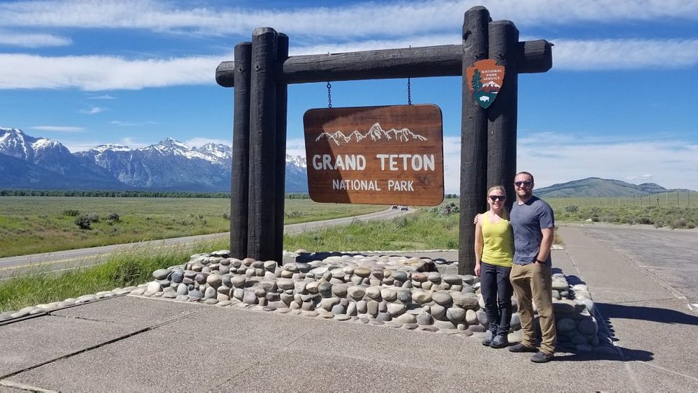
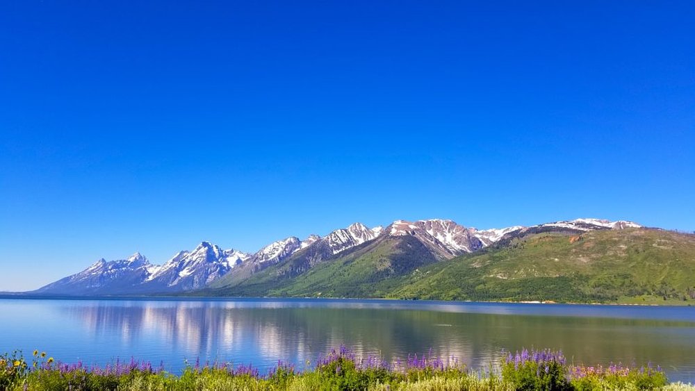
We finally arrived at Colter Bay Campground after about a 10 hour drive! The campground has beautiful cabins and camping right next to Jackson Lake set against the Grand Tetons.
Jackson Lake has an easy to follow trail along the lakeshore. But beware! It may seem that the populated trail would keep bears away, but minutes after we started we ran into a family that had just crossed paths with a mother bear. They notified the forest ranger to check out the area. And since we didn’t have our bear spray, we decided to safely turn around.
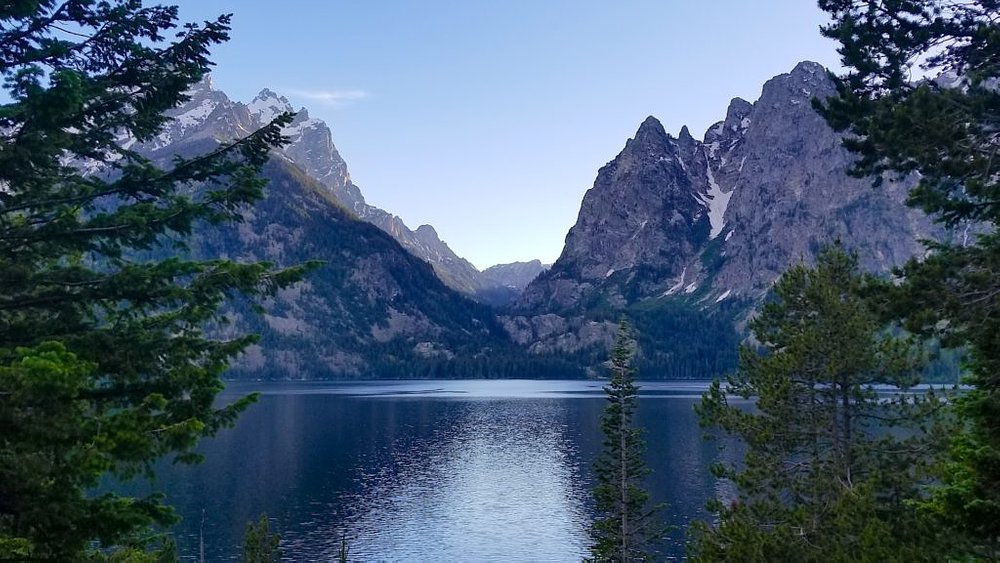
We decided to jump back into our car and explore the area on our own. We stopped at the beautiful Jenny Lake (named after me?)!
From here, we we continued for just a few miles to String Lake. If you’re interested you can complete the 3.8 mile RT String Lake hiking loop!
Jenny Lake, Hidden Falls, Inspiration Point, Jackson Hole
We had an early morning start today and drove through fields of bison!
We decided to do a ranger guided hike today, which is a great way to get comfortable with the surroundings and learn more about the Tetons. We did Inspiration Hike, which meets at Jenny Lake Visitor Center. It’s a 2.5 hour, 3 mile RT hike, with 1.5 miles of it guided. You will learn about the formation of the Tetons and hike to Hidden Falls and Inspiration Point. To reserve your space, you must get a token for each member of your group at the Jenny Lake Visitor Center the morning of the hike. This activity is limited to 25 on a first come, first served basis. You start your trip with taking the shuttle boat across Jenny Lake.
PRO TIP: This is a great, moderate hike for families! But because of that, CJ and I were little bored by the pace of the hike, but it was very informative.
Our next stop was at Hidden Falls. The falls drop approximately 100 feet near the eastern end of Cascade Canyon, and west of Jenny Lake. We then made it up to Inspiration Point, overlooking Jenny Lake! Jenny Lake is the second largest lake in the Tetons and at 423 feet is also the deepest.
PRO TIP: Jenny Lake (which is sadly not named after me) was named for a Shoshone Indian named Jenny who assisted with camp logistics during the Hayden Geological Survey of 1872. Nearby, you can find Leigh Lake, named after her husband, Richard “Beaver Dick” Leigh, a wayfaring trapper and early tour guide who helped guide the Hayden Expedition through the area.
Following the guided hike, we had the option to continue on our own, or to hike back with the group and take the boat back to the visitor center. After we gained some hiking confidence (yes, we’ve been afraid of bears), we decided to continue the rest of the Jenny Lake trail on our own.
After our hike, we were starving!! We decided to drive into Jackson Hole for lunch! It’s about a 30 minute drive from the Jenny Lake Visitor Center.
Jackson Hole is known for its upscale ski resorts and shops, campsites, and “wild west” dude ranches. It’s the lively main town, where Old West shopfronts mix with some more modern sites such as the National Museum of Wildlife Art.
We decided to eat at Liberty Burger, which has countless inventive varieties of your typical burger. Choose from beef, brisket, ahi tuna, veggie, etc! And, your options for toppings are endless here.
Our final night in the Tetons ended with a campfire made by the campfire master, CJ (notice the lighter? lol).
Yellowstone National Park: West Thumb Geyser Basin, Mud Volcano, Hayden Valley, Grand Canyon, Artist Point, Mt. Washburn
This morning we packed up our camping equipment and hit the road to Yellowstone National Park. We only had about an hour drive ahead of us, so we took our time to stop and take pictures en route.
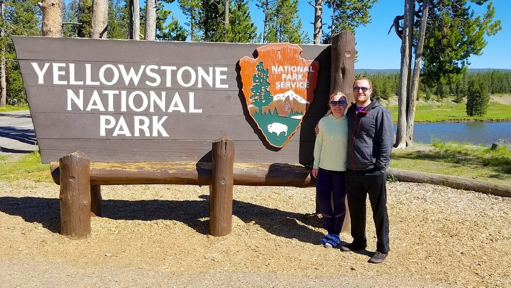
We drove to the South entrance of Yellowstone near our campground, Grant Village, and also the closest entrance to where we were coming from in the Tetons. After getting settled, we drove to the West Thumb Geyser Trail, just a few miles from the campground.
Yellowstone is a great park to visit for families. The road you follow makes a figure 8 and takes you directly to parking lots where you can get out and with a short walk you can see hot springs, geysers, and boiling mud! At many places, you will experience traffic jams from wildlife near the road and many large RVs travel slowly on this road. You can enter the park from the North, South, East, or West.
I would say that about 95% of people that travel to Yellowstone don’t venture more than 1/4 mile from the road. If you really want to experience the great outdoors, you must get off the highway and get onto a trail!
PRO TIP: Yellowstone is Americas oldest national park, established in 1872. It covers 2,219,791 acres and crosses into 3 states (WY, MT, ID)! You would need MONTHS to see it all, so plan ahead to maximize your time.
From the South entrance, we decided to head north and stick with the right side of the figure 8 road. We headed first to West Thumb Geyser Basin, the largest geyser basin on the shores of Yellowstone Lake. You can spend anywhere from 30-60 minutes here. Make sure you stay on the boardwalk the whole time as you view some of the most colorful hot springs!
Continue along the .6 mile loop around the basin and you’ll find the Fishing Cone, a hot spring with a dormant geyser located in the West Thumb Geyser Basin.
From here, we got back on the road and headed toward Mud Volcano thermal area. To reach it, drive about 6 miles north of Fishing Bridge Junction. The Mud Volcano thermal area is an area of muddy hot springs and fumaroles (hot, sulfurous vents) located near one of the Yellowstone Volcano’s vents.
As you walk along the boardwalk you will pass several hydrothermal features with very creative names such as, Sizzling Basin, Black Dragon Cauldron, Grizzly Fumarole, and Mud Cauldron!
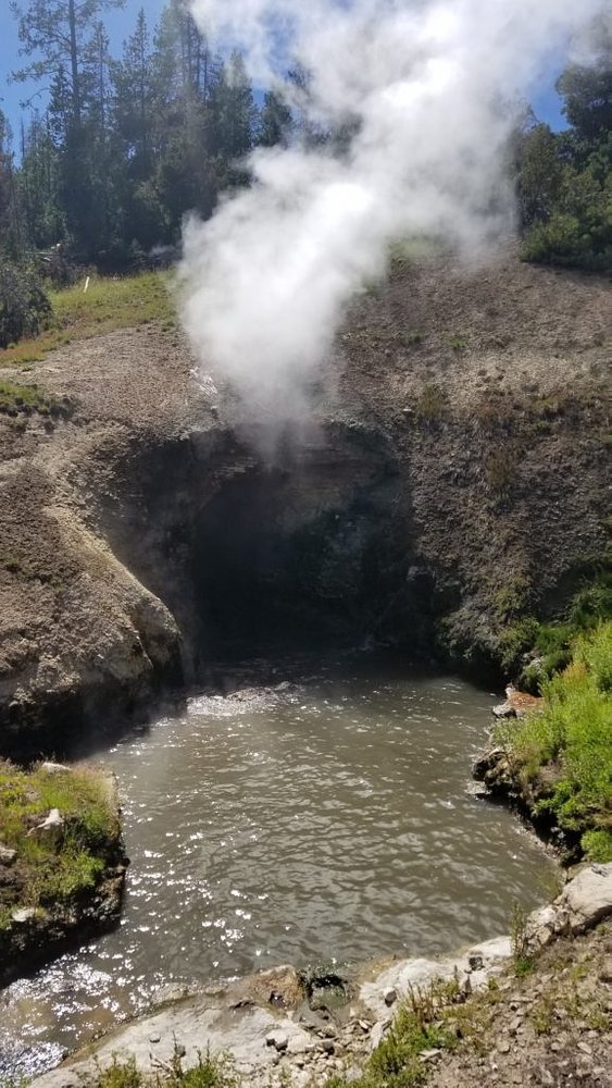
You can hike a short boardwalk (less than a quarter mile) to see Dragon mouth spring steam vent and what remains of Mud Volcano.
From here, we continued North through Hayden Valley, which is a famous spot to see wildlife, especially herds of bison and elk.
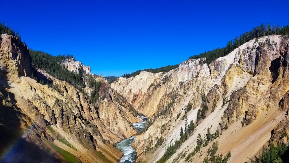
We finally made our way up to The Grand Canyon of Yellowstone! You can experience the canyon from several overlooks and choose from a number of trails to hike. You can also view the 308-foot Lower Falls and the 109-foot Upper Falls.
Artist Point is one of the famous overlooks on the Grand Canyon. It has an exceptional perspective of the Lower Falls. To get here, it is just a short tenth of mile walk from the South Rim Drive.
After spending some time here, we ventured even further North to Mt. Washburn. You can hike to the top and reach the peak which sits at an elevation of 10,243 feet via two trails: Dunraven Pass Trailhead and from the Chittenden Road parking area. Due to timing, we only hiked part of the way, but still were able to capture some amazing panoramic photos!
PRO TIP: The Dunraven Pass trailhead is 6.2 miles RT and the Chittenden Road parking area trailhead is 5 miles RT, both located south of Tower Junction.
From here, we drove South to Lake Lodge, where we met our two friends from Denver who coincidentally planned a trip to Yellowstone at the same time as us! We enjoyed dinner and catching up while taking in the beautiful scenery from their lodge.
Upper Geyser Basin, Old Faithful Geyser, Midway Geyser Basin, Grand Prismatic Spring, Norris Geyser Basin, Mammoth Hot Springs, Roosevelt Arch
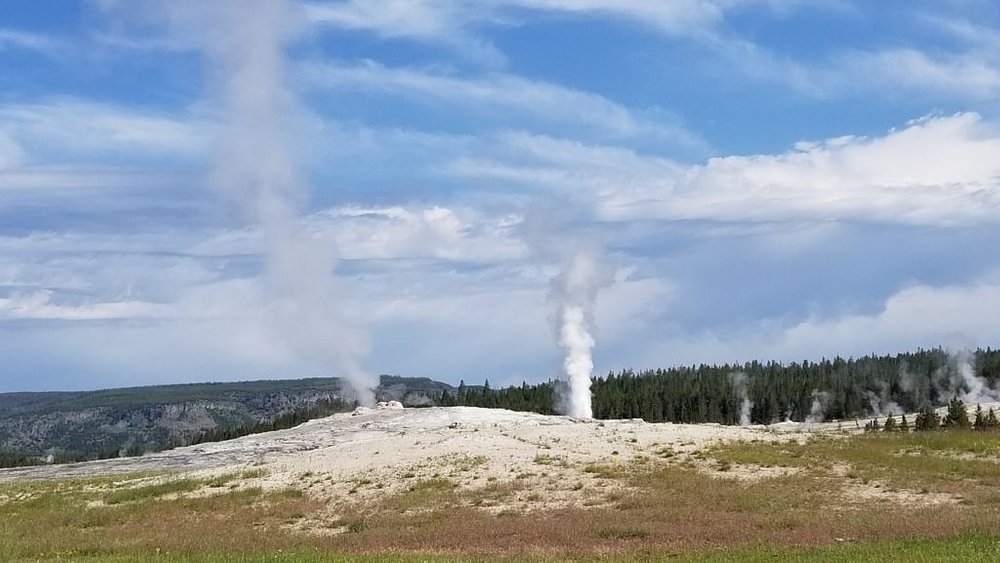
Today’s road trip started with tackling the left side of the figure 8 road. We headed to the Upper Geyser Basin to see the most famous geyser in Yellowstone: Old Faithful! We waited patiently to watch it erupt. Eruptions can last anywhere from 1.5 – 5 minutes.
PRO TIP: Did you know that Old Faithful was named for its frequent and somewhat predictable eruptions? It erupts about 20 times a day and these eruptions are predicted with 90% confidence. Check the live webcam for frequent updates and for the next anticipated eruption!
PRO TIP: To have a more intimate experience, avoid visiting the geyser from 12-6pm when bus tours and visitors typically arrive. We got there around 10am were able to find seats on the bench – and we were there in the high season of summer.
After watching it erupt, don’t just leave! Explore the many wonders of the Upper Geyser Basin! There are several other geysers, pools, and steam vents to watch!
The Morning Glory Pool is a top destination here. Unfortunately, people have thrown litter into it (coins, trash, rocks, etc) and now much of the debris has embedded in the sides affecting the water circulation and accelerating the loss of thermal energy. Morning Glory’s appearance will change as the temperature drops. The orange and yellow bacteria that formed initially on the perimeter is now spreading toward the center.
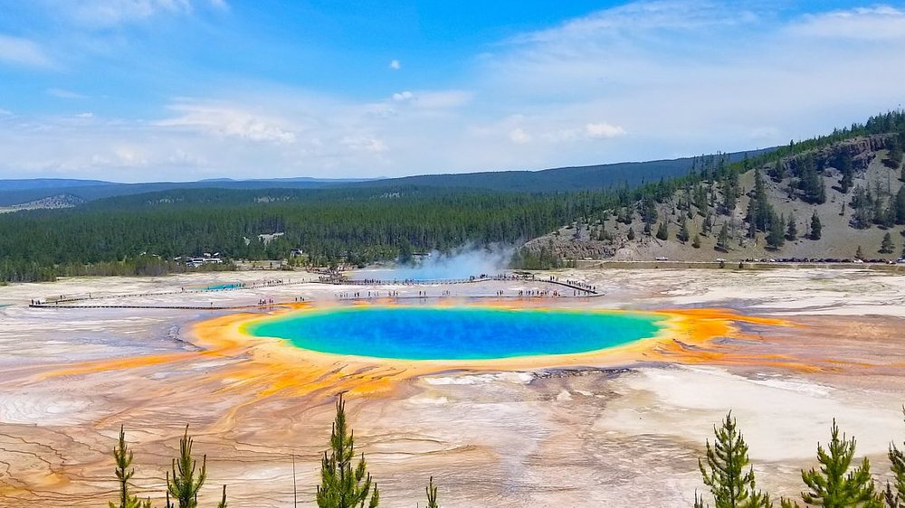
From the Upper Geyser Basin, we drove North to the Midway Geyser Basin where you can find the iconic Grand Prismatic Spring. There are two ways to visit the spring. Most people will drive to the over-crowded parking lot, wait 20-30 minutes for a spot, then walk the flat, wooden boardwalk along the perimeter of the spring.
Our experience: We opted to hike to the overlook in the middle of the day when the spring is the most vibrant. This hike is the BEST way to see the spring from above (and to capture the photo below). To reach the viewing platform, you need to get to the Fairy Falls parking lot. From there, walk over the bridge crossing the Firehole River. The trail is not well-marked, it just says ‘trail’, but there will be several people here to follow, so go with the crowd. You will reach a fork in the road, if you go right you will head towards Fairy Falls, and if you go left, you will reach the overlook platform. I do not recommend this trail for people with mobility issues.
PRO TIP: The Grand Prismatic Spring overlook trail is about 1.2 miles RT and can take 20-30 minutes there and back depending on your level of fitness.
After our hike to the overlook, we headed North yet again and reached the Norris Geyser Basin. This area is the oldest and hottest thermal areas. The basin consists of two areas: Porcelain Basin and the Back Basin. Porcelain Basin has a a 3/4 mile boardwalk trail. The Back Basin has a 1.5-mile trail of boardwalks.
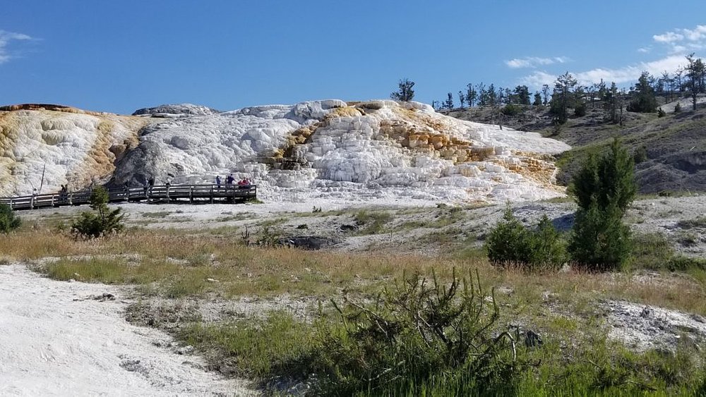
Our last stop for the day is at the top of Yellowstone: Mammoth Hot Springs. When you arrive, you will feel like you’re visiting a small town. Mammoth, WY is home to an employee housing community, Fort Yellowstone, one privately owned-home, and of course, the Mammoth Hot Spring Terraces.
To visit the lower terrace, park in the lot provided and go for a short walk until you reach the terrace itself. There is a boardwalk trail that runs from the parking lot and goes the entire length of the lower and upper terrace. The whole boardwalk is 1.75 miles. You can also take your car to the upper terrace if you don’t want to do the full walk.
If you’ve made it this far, keep going until you reach the North entrance of the park at the border of Wyoming and Gardiner, Montana – state #3 this trip! The Roosevelt Arch marks the North entrance to the park, dedicated by President Theodore Roosevelt in 1903.
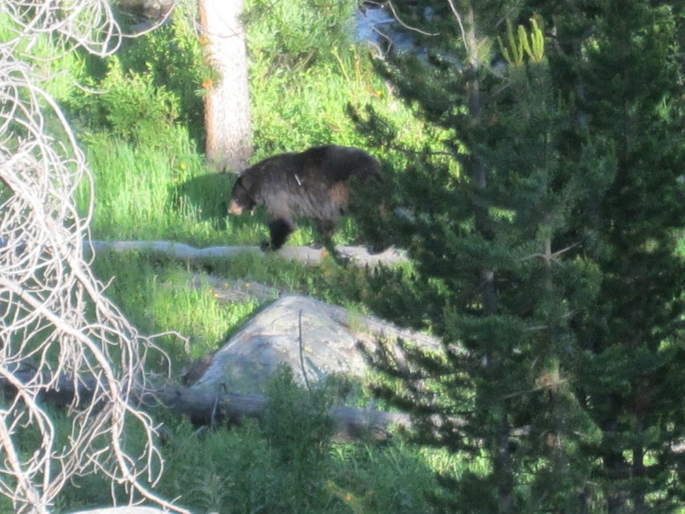
After making it to the northern most tip of Yellowstone, it was time to make the trek back to our campground. We were now about 2 hours away. Of course, it took longer as we had to stop for bear sightings!
Elephant Back Mountain trail, Yellowstone Lake cruise
This morning we wanted to get off the road after all that driving yesterday. We decided to check out Elephant Back Mountain trail. The trail goes through a dense forest for about 1.5 miles as it climbs 800 feet. You will reach a point on the trail where it splits; the left fork is the shortest trail to the top, but both reach the overlook.
As always, be on the lookout for signs of grizzly bears. When you reach the overlook, you will be met with sweeping views of Yellowstone Lake!
When we got back down to our car after the hike, the weather took a major turn and we were met with a hailstorm! The weather in the mountains can be very erratic. We were lucky up until this point to have sunny, warm weather every day of this trip.
The storm passed in a few minutes, but we weren’t too trusty of the dark clouds above us. We decided to head over to Bridge Bay and booked a scenic (enclosed) cruise on Yellowstone Lake. The boat departs from Bridge Bay Marina and heads out and around Stevenson Island. While on the water, you will be treated to an entertaining history of the area. Watch for wildlife too! Budget about an hour for this trip.
Drive back to Denver
We had a rough start to this morning. Overnight, it decided to snow and dropped about 40 degrees from the day before. We woke up at 4:30am, packed up our gear, and ventured out on hour 8+ hour drive back to Denver.
One our return home, we made a stop at the “secret” gravesite of Sacajawea in Fort Washakie, Wyoming (Wind River Indian Reservation).
I highly recommend stopping here if you need to stretch your legs. It’s really a beautiful tribute to such an extraordinary woman. You have to follow a small, unmarked road, until you reach the cemetery. You will see some ‘homemade’ signs along the way. We stopped at a convenience store for directions too.

This is great! Headed to CO in a few weeks, thank you for the tips!
Rocky Mountain National Park is incredible. Good to know about Trail Ridge Road!
The camping experience is just mesmerising, wouls like to do it one day.